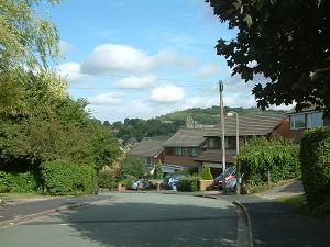 A cul de sac of 1960s and 70s large detached brick houses. Built over the saddle of a hill, many have glorious views of local hills.
Approach off Henshall Road via Ashbrook Road.
Nearest shops – Wellington Road.
Nearest pubs – Bayleaf.
Council Ward – West.
There is a page describing the possibilities for the vacant land alongside Henshall Road adjacent to Springbank and Hall Hill, known as Hall Hill fields.